


The Cattle Trail in Nesbyen
(1)
Advertisement
Photos
Jordesli
Nesbyen 3540
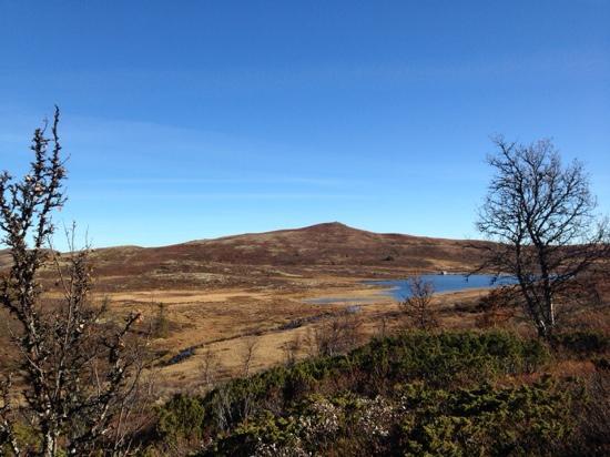
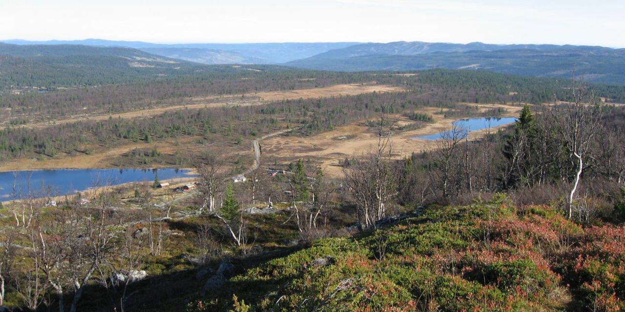
This is a small part of an old cattle road that went from Aurland in Sogn and crossed Hallingdal just below Sundre. The road then turned towards Nesningsfjella, Skalsrudstolen, Rukke and further up to Jordeslia, where there was a rest stop on one of the summer farms. ”Our” road starts just above Jordeslia and follows Driftevassbekken creek upwards. Just 200 m from the starting point, the historical society has built a small bridge over the creek. There's an info sign here. About 3 km further on, the road passes a giant pine tree. Jorgen Holm has named it Kvilningsfuro, The Rest Pine. An examination of the growth rings revealed that the tree is about 550 years old a living organism from medieval times. A visit to the pine is worth the hike in itself. There's an info board and 2 good benches by the tree. About 1 km further, you'll arrive at Kvilningsberget, The Rest Rock. There are benches here as well and a great view towards the Hemsedal mountains and Reineskarvet. You can also see Hallingskarvet in the distance, and several idyllic fishing waters. The cattle road (not cleared) continues into the mountains, passing Brynhildstjern, Hallingnatten and Reinsjoen on its way towards Norefjell. The old cattle road went all the way to Branes/Drammen and the Kongsberg area. Our part of the cattle road was cleared by Nes historical society between 2001 and 2003 and marked with marker sticks. There's a good info board at the starting point in Jordeslivegen. 4 info boards in all. Slight incline. Beautiful hiking terrain (900-1000 masl.) Some marshland at the top after app. 4 km. 5.3 km in total, 1 hour with normal walking speed.
See a problem?
You might also like

Norway›The Cattle Trail in Nesbyen
Advertisement