Åkrefjell and Trommenatten

tripadvisor logo

(5)

Website

Advertisement

Photos

5 Jordeshagen
Nesbyen 3540
An easy-going and varied tour where you can cross off two of the most popular mountain peaks in Nes Sørmark. The trip starts almost 1,000 meters above sea level and offers open high mountain terrain and long views in all directions. On clear weather days, you get a great view of Hallingskarvet and Hemsedalsfjella. Åkrefjell rises 1209 m above sea level, while Trommenatten is 1176 m above sea level. The trip starts and ends on a gravel road, but most of the trip is on well-trodden paths. Red-marked posts mark the round trip. Parts of the path go over marshes, so you must be prepared for wet sections, especially between Øyvatn and Trommenatten. The tour can be started from Nystølkroken Kafè or from the car park at Båtstjernlia, which we suggest here. Start on a gravel road south towards Åkrefjell. The road goes over a mound, then past the east bank of idyllic Østre Båtstjern. After 2 km the road turns into a path, keep right. Follow the path all the way to the top of Åkrefjell, where you deserve a breather on the ground. Enjoy the view! From Åkrefjell it carries back in the same direction for 3-400 metres, before the path continues south (signposted to Øyvatn/Hallingnatten). Follow the path for 1.5 km to the junction at the southern end of the large lake Øyvatn. Here you head north, follow the red poles. About 2 km after the Øyvatn crossing you will come to the crossing towards Trommenatten. If you have the energy for it, we recommend the side trip back and forth to the top of Trommenatten. Back at the kiss you continue north, after a while you are back on the dirt road. Follow this back to the car park. Feel free to end with an ice-cold glass and a home-cooked meal at Nystølkroken Kafè, just under a kilometer north of the car park. Good trip!

Reviews

tripadvisor logo
4.55 reviews
Photo of Pål S
Good for a mtb ride
7/14/2020

I went there on a mtb bike, some pushing of the bike up, and a nice ride back down. Hard but fun. Re...

Photo of joojoooh
Hiking in trommenatten
8/7/2017

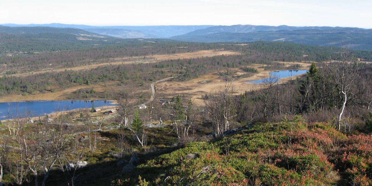
I had a very pleasant hike in trommenatten, easy (2-3 hours return) , quiet with a very nice view af...

Own this business?
See a problem?

You might also like

The Cattle Trail in Nesbyen

The Cattle Trail in Nesbyen

1
This is a small part of an old cattle road that went from Aurland in Sogn and crossed Hallingdal just below Sundre. The road then turned towards Nesningsfjella, Skalsrudstolen, Rukke and further up to Jordeslia, where there was a rest stop on one of the summer farms. ”Our” road starts just above Jordeslia and follows Driftevassbekken creek upwards. Just 200 m from the starting point, the historical society has built a small bridge over the creek. There's an info sign here. About 3 km further on, the road passes a giant pine tree. Jorgen Holm has named it Kvilningsfuro, The Rest Pine. An examination of the growth rings revealed that the tree is about 550 years old a living organism from medieval times. A visit to the pine is worth the hike in itself. There's an info board and 2 good benches by the tree. About 1 km further, you'll arrive at Kvilningsberget, The Rest Rock. There are benches here as well and a great view towards the Hemsedal mountains and Reineskarvet. You can also see Hallingskarvet in the distance, and several idyllic fishing waters. The cattle road (not cleared) continues into the mountains, passing Brynhildstjern, Hallingnatten and Reinsjoen on its way towards Norefjell. The old cattle road went all the way to Branes/Drammen and the Kongsberg area. Our part of the cattle road was cleared by Nes historical society between 2001 and 2003 and marked with marker sticks. There's a good info board at the starting point in Jordeslivegen. 4 info boards in all. Slight incline. Beautiful hiking terrain (900-1000 masl.) Some marshland at the top after app. 4 km. 5.3 km in total, 1 hour with normal walking speed.
Brusetrunden

Brusetrunden

Varied forest terrain, 871 m.a.s.l. Start at the small bridge at the outlet of Myking sea (east peak), follow the blue and red markings along the south side of the hillside Strykjernet to the outcrop. Go right into the forest and follow the trail up toward the hillside Bruslett. The trail crosses a flat marshland (wet), goes downhill a bit until it reaches the car road to Bruset. Follow the car road, stay to the right in the first crossroad and keep going through up the cabin area. Keep to the right at the end of the road, look for signs: Alt. 1. Myking or alt. 2 Gronhovd. Alt. 1. Towards Myking: Walk below the cabins and follow the marked trail to the north end of the lake Mykingsjoen where the brook ends. Cross the brook and follow the marked trail. If you turn left along the right side of the brook, you’ll get to Ranten/Gronhovd. If you go to the right (straight ahead), you’ll get to a cabin area or further up to the road back to start at the small bridge. Alt 2. to Gronhovd. Get off the trail by the sign marked Gronhovd. Beautiful birch forest heights. Starting point: East peak of Myking sea. Parking: Large P-ground in the end of the road. Directions: From Nesbyen up Rukkedalen, get on the road towards Myking (toll bar) at the crossroad by Rukke after appox. 13 km. Follow the road approx. 4 km and take left down to the outlet of the Myking sea. Km: 8,7 km, App. time at normal pace: 1hr 30 min. GPS: hallingkart.no. Skilt: Blue + red color on rocks/trees. Rest stops: The top of Bruset. The end of the brook north of the lake Mykingsjoen. Along the birch forest heights after you get off towards Gronhovd. Hiking map can be bought at the tourist information, bookstore, and tourist businesses.
NorwayÅkrefjell and Trommenatten

Advertisement